")


Immersive user experience
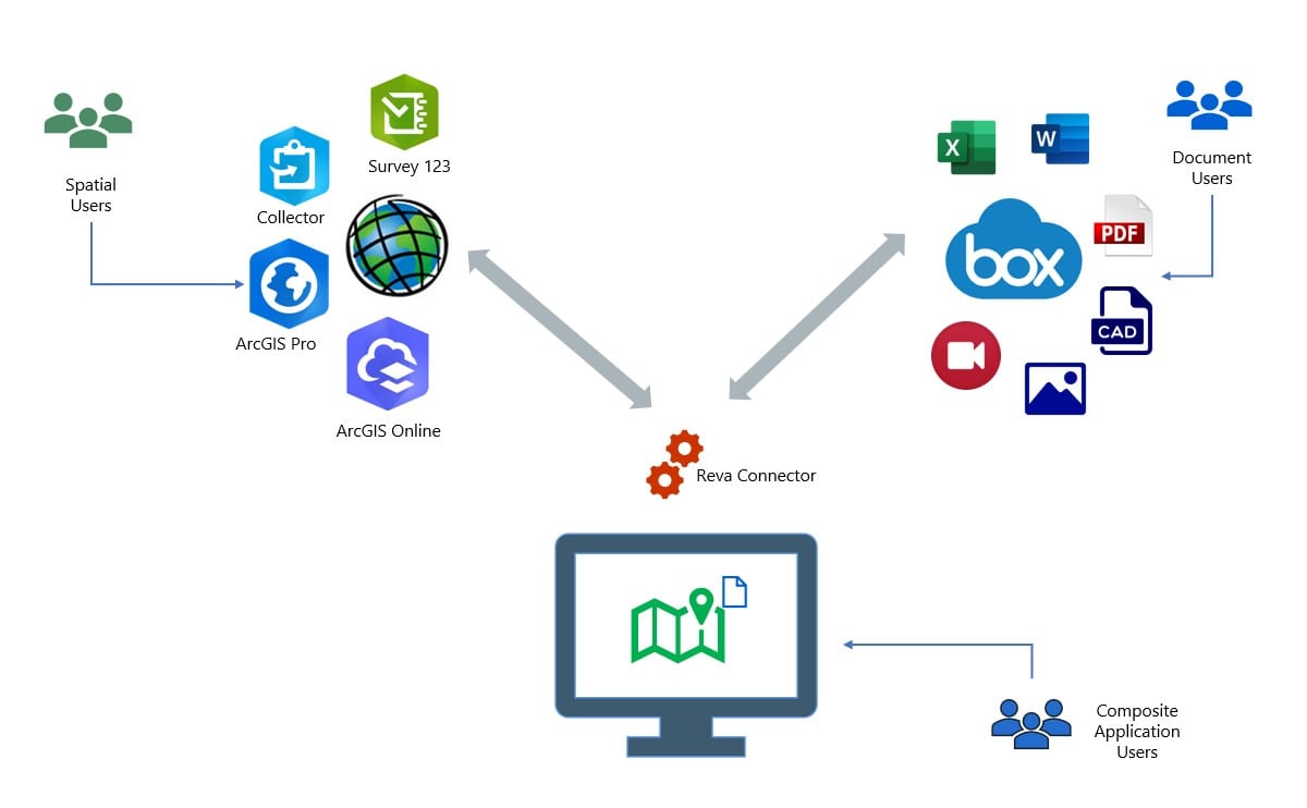
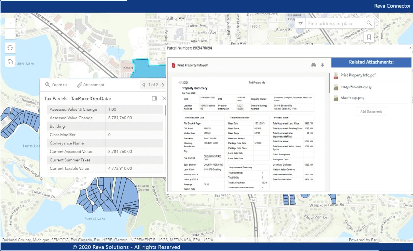
Dynamically display Box documents related to a geographic map feature in ArcGIS.

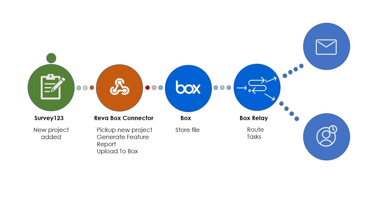
Upload Documents
Dynamically display Box documents related to a geographic map feature in ArcGIS.

Retrieve data in real-time
Dynamically display Box documents related to a geographic map feature in ArcGIS.

Easily configurable
Dynamically display Box documents related to a geographic map feature in ArcGIS.

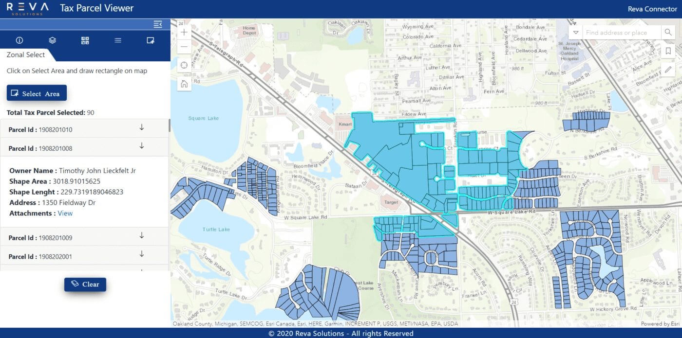
Zonal search
Seamless search for documents by location/feature on the map.
space

Extensive integrations
Deep integrations with applications like ArcGIS online, Portal, Survey123, Collector, and many more!