ESRI ArcGIS - Box Connector

An ArcGIS – Box Integration

Reva Connector provides an efficient and time-saving interaction between ArcGIS interface and Box. This ArcGIS and Box integration allows users to view, search, upload, and manage documents into Box through ArcGIS interface.

Overview

ArcGIS by Esri is a popular geospatial tool that is used by several organizations to create, manage, share, and analyze spatial data. All these features combined with advanced content management capabilities of Box create a powerful and cost-efficient tool beneficial to any size organization. Reva Connector will replace the complication of tracking files back and forth in Box folders by mapping it into the geographical system. Therefore, helping the organizations to improve their daily efficiency and making information more readily available.

How does it work?

The dynamic ArcGIS map will auto-populate to indicate which features on the map have Box stored documents associated with them. The ArcGIS feature services will display the metadata from Box along with other attributes related to that feature. Documents stored in the Box folders will be displayed as attachments within the feature layer and will be viewable in ArcGIS as well, making everything accessible all at one place. By bringing data to the map, users will have a spatial view of their content.

Features

Immersive user experience

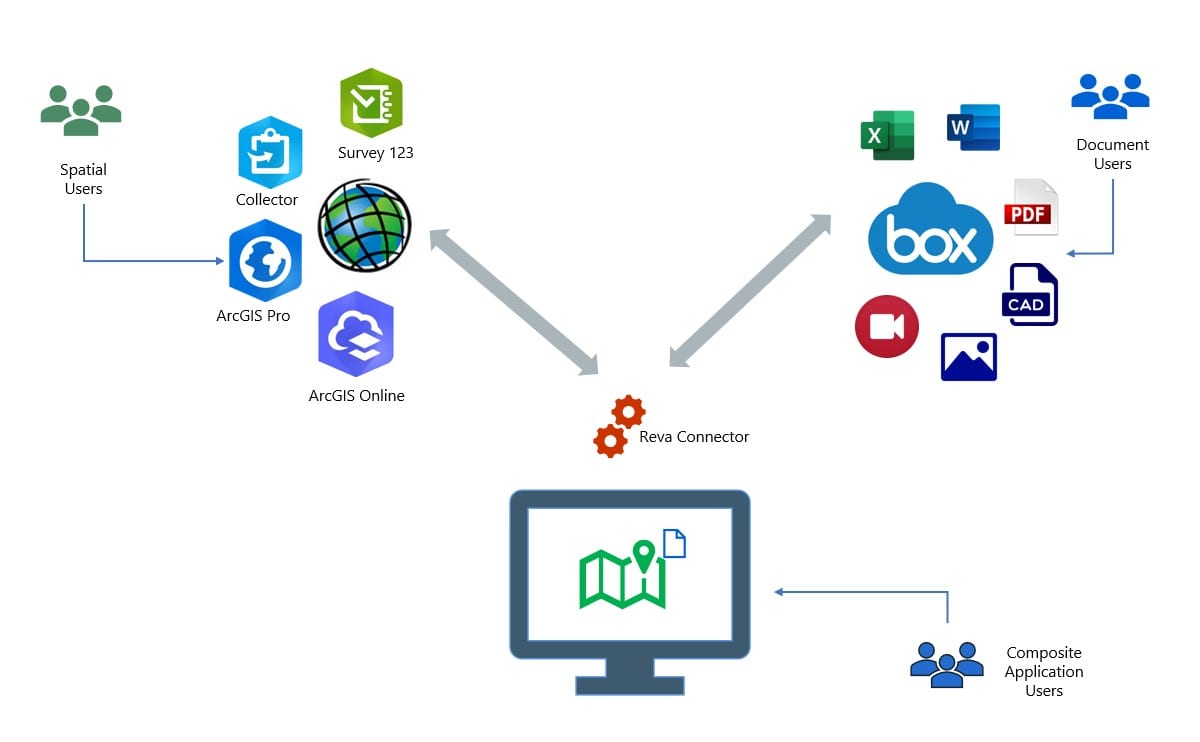
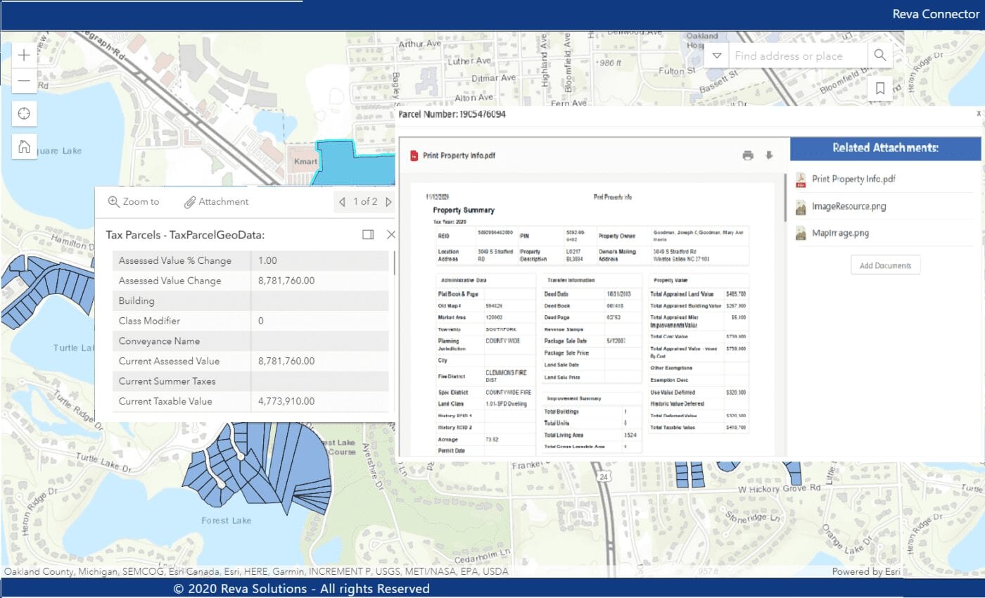
Dynamically display Box documents related to a geographic map feature in ArcGIS.
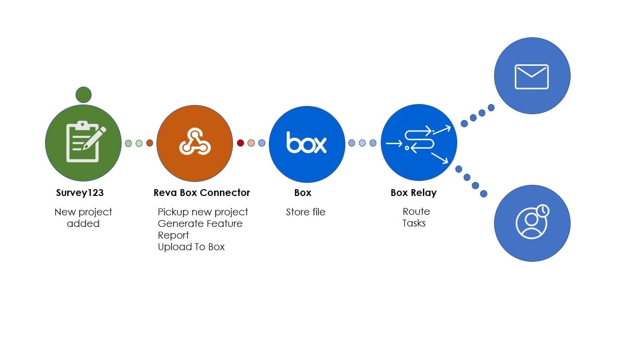
Upload Documents

Upload documents to Box directly from ArcGIS and automatically apply ArcGIS feature context to content for classification and management.

Retrieve data in real-time

Documents in Box are immediately available on the ArcGIS maps as information is pulled in real-time.

Easily configurable

Enables easy configuration from basic to advanced use cases, with no coding required.
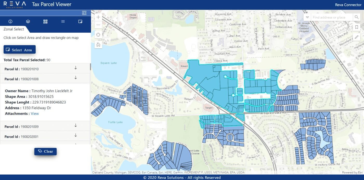
Zonal search

Seamless search for documents by location/feature on the map.

space

Extensive integrations

Deep integrations with applications like ArcGIS online, Portal, Survey123, Collector, and many more!

Benefits

Increased user productivity

Realize results faster with access to the documentation users need, without leaving ArcGIS.

Accelerated decision-making process

Organizations can accelerate decision-making by connecting all related documents to map features for a complete location analysis.

Improved user adoption

Users will be able to view documents that they need in order to make informed decisions, move business processes forward, and improve customer service.

Greater control and governance

Enable business users access to the right version of information, while seemlessly addressing compliance, regulatory and record keeping demands.